Ever found yourself daydreaming, looking up at the sky, and wondering what your own house looks like from way up there? What was once technology reserved for spy agencies and top-level weather forecasters is now accessible to just about everyone. Thanks to incredible leaps in high-resolution satellite technology, you can digitally “fly” over your own neighborhood and see your home in stunning detail. Whether you’re planning a backyard renovation, checking out a new property, or just want to satisfy that curiosity, accessing satellite imagery is easier than you think.
What Is High-Resolution Satellite Imagery?
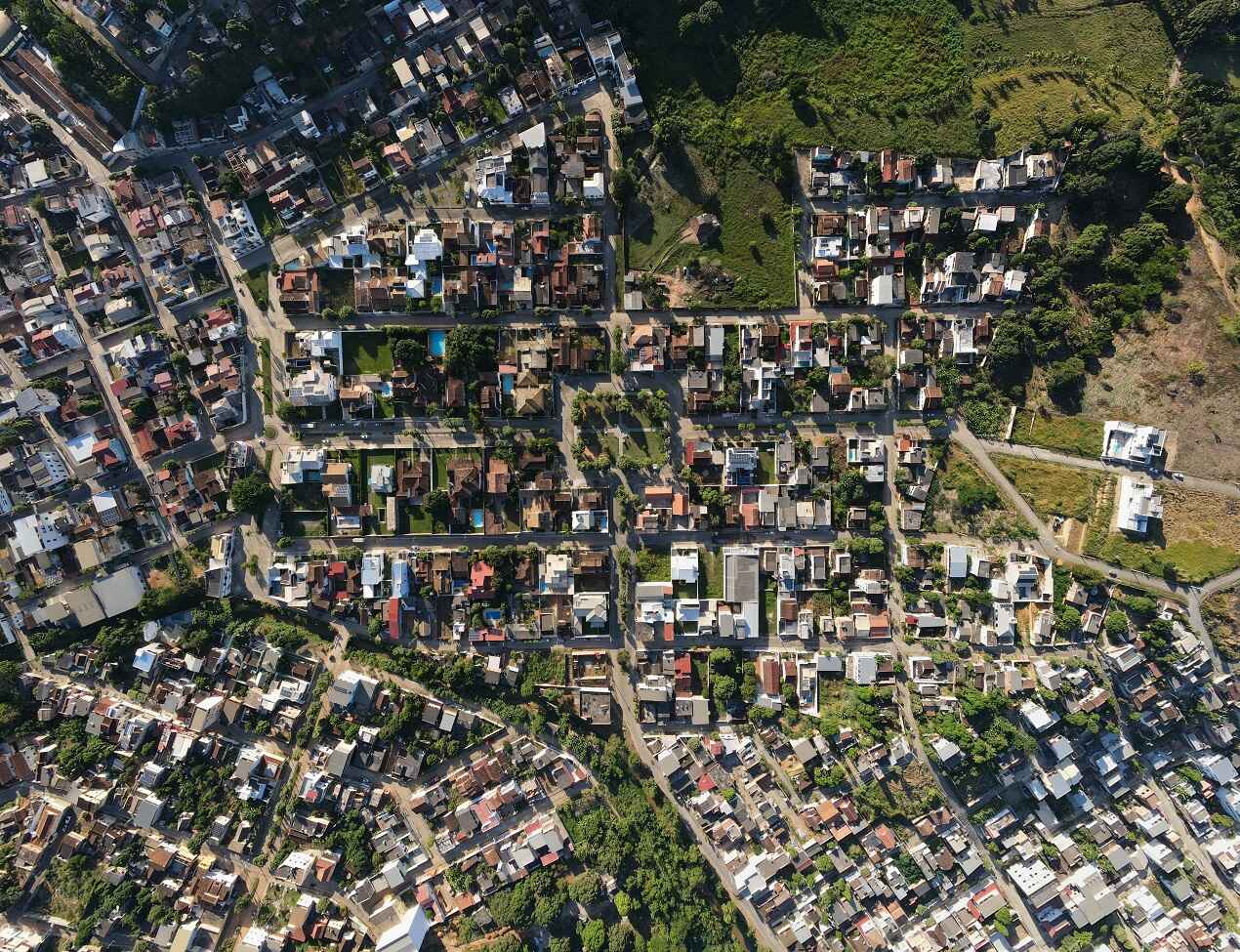
When you think of a real-time satellite view of my location, you might picture a blurry, continent-wide map from a weather report. That’s low-resolution imagery, great for seeing massive features like forests and coastlines. High-resolution imagery, however, is a different beast entirely. We’re talking about a level of detail so sharp it can capture features on the ground as small as 30-50 centimeters. It means you can see:
- The sharp, distinct outline of your rooftop.
- Individual trees and the layout of your garden.
- The specific path of your driveway and property fences.
- Shadow your house casts across the lawn on any time of day.
The data is collected by thousands of advanced Earth-observation satellites orbiting Earth. The best-quality images are often called “Very High Resolution” (VHR), where a single pixel in the image represents a square on the ground less than 50cm wide.
Where to View Your House from Satellite
You have several great options for seeing your home from above, ranging from everyday apps to specialized professional platforms.
1. Google Earth & Google Maps
Developed by Google, this tool is free, fast, and accessible. It lets you search any address with 3D fly-around features. The main drawback? It is not a live satellite view. Imagery is updated once in years, and often you can see only what happened around your house ten years ago.
2. Special High-Resolution Platforms
Need something sharper and more up-to-date? Platforms like EOSDA LandViewer provide access to current satellite images that are updated daily. With resolution sharp enough to spot details as small as 30cm, these tools let you track changes over time with precision.
3. Government & Space Agency Sources
Free imagery can also be delivered by public agencies NASA and the European Space Agency. It’s updated frequently and perfect for tracking large-scale environmental changes, but the resolution is too low to see individual house details.
How to Find Your House Using Satellite Tools
Let’s be honest: the first thing anyone does with these tools is look up their own address! While every app looks a little different, the basic steps to get there are almost always the same.
Here is a simple guide to get you started:
- Start with a Search: Find the search bar, it’s usually right at the top, type in your full home address, and hit enter.
- Switch Modes: Most maps start in a standard road view. Look for a button or layer icon labeled “Satellite” or “Imagery.” Click that, and you’ll instantly swap the digital map for a photographic current satellite view.
- Zoom All the Way In: Use your mouse wheel or pinch the screen on your phone. Keep zooming until your roof, driveway, and property lines come into sharp focus.
- Travel Back in Time: Platforms like Google Earth often have a “timeline” feature that lets you scroll back through the years to see how your neighborhood has grown or changed over time.
- Get Technical: If you’re planning a project, look for the ruler icon. These tools let you measure your fence line or calculate your lawn’s square footage without ever stepping outside.
Why Look at Your House from a Satellite?
People are using current satellite views for much more than just satisfying their curiosity. This technology offers powerful, real-world insights for homeowners, buyers, and even businesses. So, why would you need a satellite view of your house?
- Smarter Home Planning: Thinking of putting in a pool or a new deck? Don’t just guess. Satellite views let you measure your yard down to the inch and even check exactly where the shadows fall in the afternoon, all before you buy a single shovel.
- Safety & Risks: Sometimes the biggest risks are hard to spot from the driveway. A bird’s-eye view can reveal hidden erosion patterns or potential flood zones you might miss.
- Legal Proof: A picture is worth a thousand words, and that’s definitely true in court. Whether it’s a boundary dispute with a neighbor or a zoning issue, a clear, dated satellite image is an unbiased proof of your property’s history.
How High-Resolution Imagery Makes the Difference
So, what is the real-world advantage of high resolution? It comes down to clarity. While standard maps might just show a blurry green blob where your garden sits, the best live satellite view available allows you to see the details that actually count. You can inspect your rooftop for potential damage after a major storm, check on the progress of a new construction or landscaping project, or identify small features like driveway cracks or changes in your garden layout. This precision is what makes the most current satellite imagery an indispensable tool.